Moated sites in Essex
Introduction
Essex contains one of the largest concentrations of recorded medieval moated sites in all of England, with estimates of well over 900 examples scattered throughout the county's historic landscape. Most of these moats (built largely between 1250 and 1350) served as high-status or prestigious domestic residences for lords, manorial tenants, and prosperous farmers rather than functional military defences.
Distribution
Around 6,000 moated sites are known in England, therefore Essex makes up around 15% of the known sites across the country. Most of these are located in the western part of the county (see distribution map), where clayey, tillable soil has meant both denser settlement activity and more water retention.
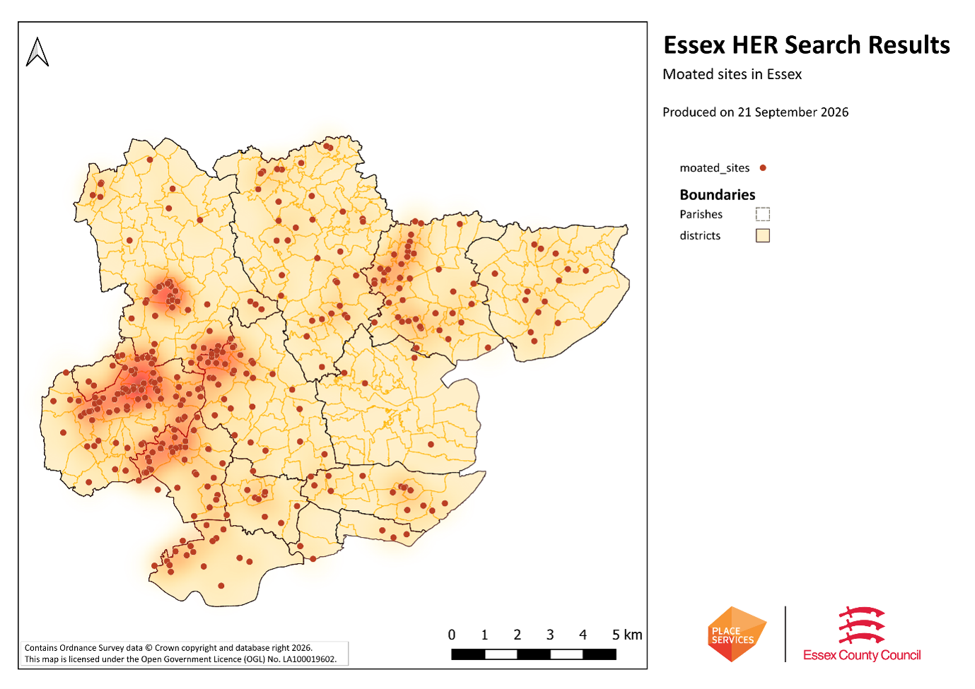
Moated sites in Essex
A distribution map showing the location of moated sites in Essex.
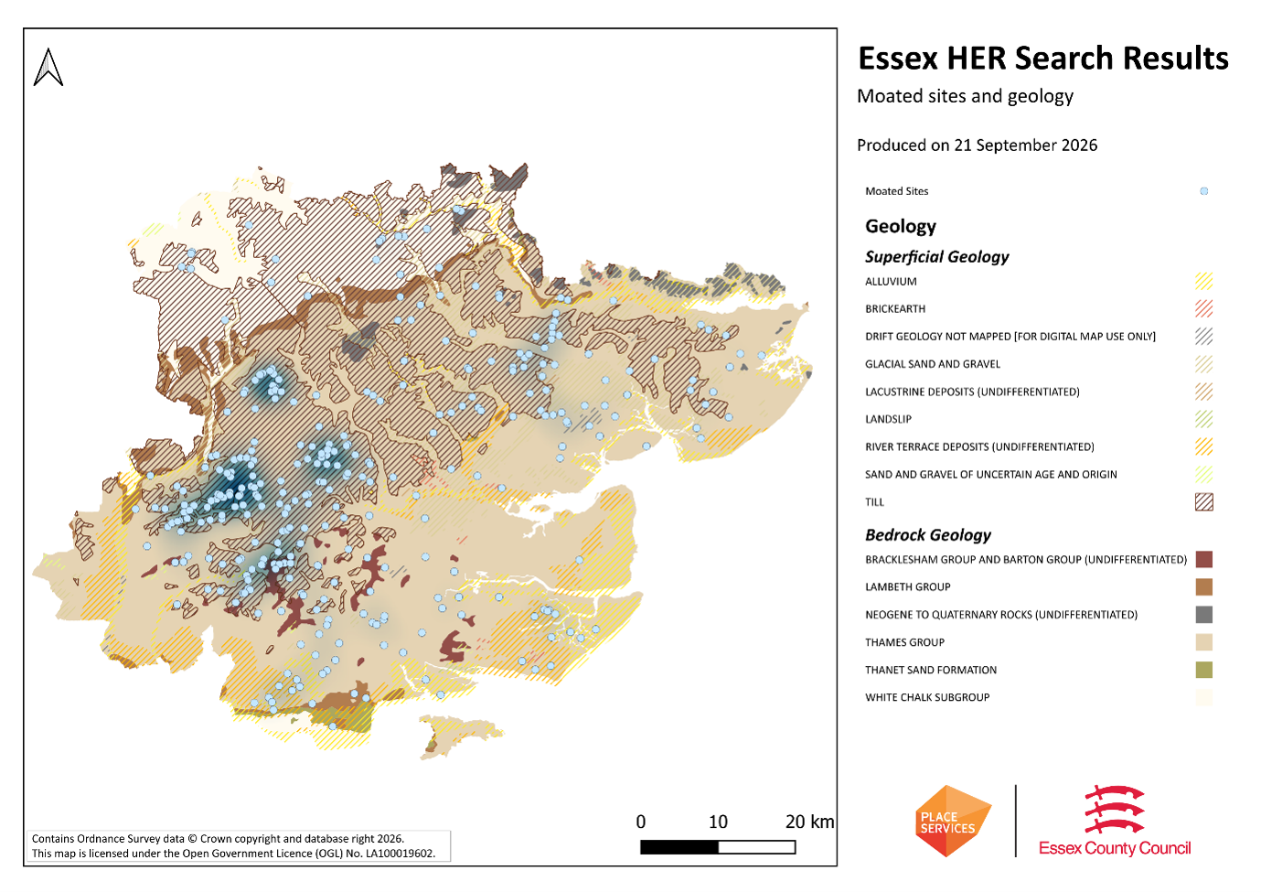
Moated sites and geology
A distribution map showing moated sites in Essex relative to the geology of the county.
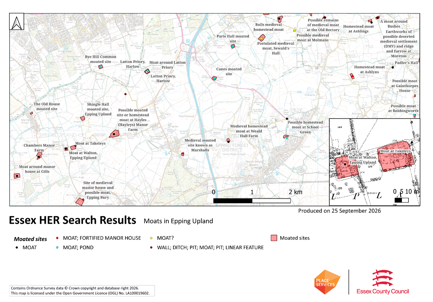
Moats in Epping Upland
A map showing moated sites in Epping Upland.
Significance
Most moated sites served as prestigious aristocratic and seigneurial residences with the provision of a moat intended as a status symbol rather than a practical military defence. For example, the moat at Takeleys (EHER 3728) was around a manor house; meanwhile the moat at Walton (EHER 3825) to its immediate west was originally around a vicarage. The peak period during which moated sites were built was between about 1250 and 1350 - however, moated sites were built throughout the medieval period. They form a significant class of medieval monument and are important for the understanding of the distribution of wealth and status in the countryside. Many examples provide conditions favourable to the survival of organic remains and environmental evidence, helping us understand the medieval landscape and the economy of its inhabitants. They dominate the landscape of rural Essex, and serve as a reminder of the medieval period.
Appearance
How can one recognise a moated site, as they exhibit a high
level of diversity in their forms and sizes? Usually, the first step is to look
at earthwork evidence, either from earthwork surveys or LiDAR evidence. They
usually have a singular wide, rectangular or sub-rectangular ditch, often or
seasonally water-filled, partly or completely enclosing one or more islands of
dry ground; on which stood domestic or religious buildings (around 40m-100m
across on average). In some cases, the islands were used for horticulture. One
can verify them via documentary evidence, for example using historic Ordnance Survey mapping (which often has them labelled as ‘moat’), or local historical
monographs that mention significant manors in the area. Many were converted to
ponds (see map) or left dry in the modern period.
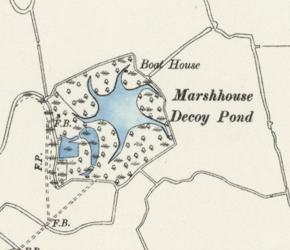 Situated on the Tillingham Marshes at the eastern end of the
Dengie Peninsula is an unusual and important historic monument. When viewed
from the nearby footpath, the location of the monument is marked by a small and
dense forest. But the forest hides a star-shaped pond, which begins to reveal
itself on the modern Ordnance Survey (OS) map. It’s true extent is best
represented on the historic OS map, which illustrates the six original ‘arms’
that fan out from the centre of the pond and curve around the feature in a
clockwise direction.